Search results for Data Visualization
Filters
Portal
- All portals
- GovData Germany3,159
- data.gov.au2,433
- Opendatasoft hub771
- data.gov.uk768
- Humanitarian Data Exchange651
- data.gouv.fr442
- Data.gov Catalog403
- Socrata network245
- Open Government Canada218
- California Open Data194
- Data.NSW159
- data.gov.ie104
- BC Data Catalogue53
- data.overheid.nl45
- Queensland Government Open Data32
- openAFRICA7
- DATA.GOV.HK3
9,687 datasets for “Data Visualization”
- data.gov.au
Mapping the deep ocean: Geoscience Australia and the search for MH370
Geoscience Australia DataUpdated 2 Mar 2026
… About the data visualisation: This video contains data visualisation and animation sequences. Bathymetry visualisations are derived from data …
- HTML
- MP4
- data.gov.au
Mapping the deep ocean: Geoscience Australia and the search for MH370
Geoscience Australia DataUpdated 7 Mar 2026
… About the data visualisation: This video contains data visualisation and animation sequences. Bathymetry visualisations are derived from data …
- HTML
- MP4
- data.gov.au
Mapping the deep ocean: Geoscience Australia and the search for MH370
Geoscience Australia DataUpdated 25 Mar 2026
… About the data visualisation: This video contains data visualisation and animation sequences. Bathymetry visualisations are derived from data …
- HTML
- MP4
- data.gov.au
Mapping the deep ocean: Geoscience Australia and the search for MH370
Geoscience Australia DataUpdated 20 Apr 2026
… About the data visualisation: This video contains data visualisation and animation sequences. Bathymetry visualisations are derived from data …
- HTML
- MP4
- data.gov.au
Mapping the deep ocean: Geoscience Australia and the search for MH370
Geoscience Australia DataUpdated 30 Apr 2026
… About the data visualisation: This video contains data visualisation and animation sequences. Bathymetry visualisations are derived from data …
- HTML
- MP4
- Socrata networkLive preview
Maryland_Military_Training_Route_1_500___Above
opendata.maryland.govUpdated 22 Jul 2025
… Routes are divided into visual rules (VR) and instrument rules (IR, at night and in poor weather conditions …
- CSV
- JSON
- SODA API
- data.gouv.fr
Stations en open-data du réseau météorologique Infoclimat (Réseau StatIC)
Association InfoclimatUpdated 25 May 2022
… BY-NC) 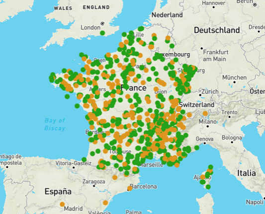
- JSON
- data.gov.uk
Protected Zone Plots For Bark Beetle Species GB 10K Grid
Forestry CommissionUpdated 25 Jul 2025
… Survey undertaken includes visual inspection and destructive sampling and included baited (pheromone lure) log traps. Plots are located …
- data.gov.au
Mapping the deep ocean: Geoscience Australia and the search for MH370
Australian Ocean Data NetworkUpdated 11 Jan 2026
… About the data visualisation: This video contains data visualisation and animation sequences. Bathymetry visualisations are derived from data …
- HTML
- MP4
- data.gov.au
Mapping the deep ocean: Geoscience Australia and the search for MH370
Australian Ocean Data NetworkUpdated 23 Jan 2026
… About the data visualisation: This video contains data visualisation and animation sequences. Bathymetry visualisations are derived from data …
- HTML
- MP4
- data.gov.au
Mapping the deep ocean: Geoscience Australia and the search for MH370
Australian Ocean Data NetworkUpdated 12 Feb 2026
… About the data visualisation: This video contains data visualisation and animation sequences. Bathymetry visualisations are derived from data …
- HTML
- MP4
- data.gov.au
Mapping the deep ocean: Geoscience Australia and the search for MH370
Australian Ocean Data NetworkUpdated 5 Mar 2026
… About the data visualisation: This video contains data visualisation and animation sequences. Bathymetry visualisations are derived from data …
- HTML
- MP4
- data.gov.au
Mapping the deep ocean: Geoscience Australia and the search for MH370
Australian Ocean Data NetworkUpdated 16 Mar 2026
… About the data visualisation: This video contains data visualisation and animation sequences. Bathymetry visualisations are derived from data …
- HTML
- MP4
- data.gov.au
Mapping the deep ocean: Geoscience Australia and the search for MH370
Australian Ocean Data NetworkUpdated 29 Mar 2026
… About the data visualisation: This video contains data visualisation and animation sequences. Bathymetry visualisations are derived from data …
- HTML
- MP4
- data.gov.au
Mapping the deep ocean: Geoscience Australia and the search for MH370
Australian Ocean Data NetworkUpdated 4 Apr 2026
… About the data visualisation: This video contains data visualisation and animation sequences. Bathymetry visualisations are derived from data …
- HTML
- MP4
- data.gov.au
Mapping the deep ocean: Geoscience Australia and the search for MH370
Australian Ocean Data NetworkUpdated 10 Apr 2026
… About the data visualisation: This video contains data visualisation and animation sequences. Bathymetry visualisations are derived from data …
- HTML
- MP4
- data.gov.au
Mapping the deep ocean: Geoscience Australia and the search for MH370
Australian Ocean Data NetworkUpdated 16 Apr 2026
… About the data visualisation: This video contains data visualisation and animation sequences. Bathymetry visualisations are derived from data …
- HTML
- MP4
- data.gov.au
Mapping the deep ocean: Geoscience Australia and the search for MH370
Australian Ocean Data NetworkUpdated 5 May 2026
… About the data visualisation: This video contains data visualisation and animation sequences. Bathymetry visualisations are derived from data …
- HTML
- MP4
- data.gov.au
Mapping the deep ocean: Geoscience Australia and the search for MH370
Australian Ocean Data NetworkUpdated 4 Jun 2026
… About the data visualisation: This video contains data visualisation and animation sequences. Bathymetry visualisations are derived from data …
- HTML
- MP4
- data.gov.au
Mapping the deep ocean: Geoscience Australia and the search for MH370
Australian Ocean Data NetworkUpdated 17 Jun 2026
… About the data visualisation: This video contains data visualisation and animation sequences. Bathymetry visualisations are derived from data …
- HTML
- MP4