Search results for Data Visualization
FiltersJSON
Portal
1,854 datasets for “Data Visualization”
- Opendatasoft hubLive preview
Interne - Critères Ensembles intercommunaux OFGL [2023]
INTERNEUpdated 20 Jul 2026
… Il est nécessaire aux data-visualisations.
- CSV
- JSON
- GEOJSON
- ODS API
- Opendatasoft hubLive preview
Interne - Critères Ensembles intercommunaux OFGL [2025]
INTERNEUpdated 28 Jul 2026
… Il est nécessaire aux data-visualisations.
- CSV
- JSON
- GEOJSON
- ODS API
- Socrata networkLive preview
Electronic Police Report 2010
Police Department (NOPD)Updated 30 Jun 2026
… All data visualizations on maps should be considered approximate and attempts to derive specific addresses are strictly prohibited …
- CSV
- JSON
- SODA API
- Opendatasoft hubLive preview
Chronic: HTML template with JavaScript for social-ecological timelines
CNRS / ICUBEUpdated 20 Feb 2025
… Open the HTML file using Visual Studio Code or any other text editor. Update the data using the …
- CSV
- JSON
- GEOJSON
- ODS API
- Opendatasoft hubLive preview
Interne - Critères GFP OFGL [2020]
INTERNEUpdated 17 Jul 2020
… Il est nécessaire aux data-visualisations.
- CSV
- JSON
- GEOJSON
- ODS API
- Opendatasoft hubLive preview
Interne - Critères GFP OFGL [2021]
INTERNEUpdated 12 Jul 2024
… Il est nécessaire aux data-visualisations.
- CSV
- JSON
- GEOJSON
- ODS API
- Opendatasoft hubLive preview
Interne - Critères GFP OFGL [2022]
INTERNEUpdated 12 Jul 2024
… Il est nécessaire aux data-visualisations.
- CSV
- JSON
- GEOJSON
- ODS API
- Opendatasoft hubLive preview
Interne - Critères GFP OFGL [2023]
INTERNEUpdated 11 Dec 2024
… Il est nécessaire aux data-visualisations.
- CSV
- JSON
- GEOJSON
- ODS API
- Opendatasoft hubLive preview
Interne - Critères GFP OFGL [2025]
INTERNEUpdated 20 Jul 2026
… Il est nécessaire aux data-visualisations.
- CSV
- JSON
- GEOJSON
- ODS API
- Socrata networkLive preview
Electronic Police Report 2012
Police Department (NOPD)Updated 30 Jun 2026
… All data visualizations on maps should be considered approximate and attempts to derive specific addresses are strictly prohibited …
- CSV
- JSON
- SODA API
- Socrata networkLive preview
Maryland_Military_Training_Route_1_500___Above
opendata.maryland.govUpdated 22 Jul 2025
… Routes are divided into visual rules (VR) and instrument rules (IR, at night and in poor weather conditions …
- CSV
- JSON
- SODA API
- data.gouv.fr
Stations en open-data du réseau météorologique Infoclimat (Réseau StatIC)
Association InfoclimatUpdated 25 May 2022
… BY-NC) 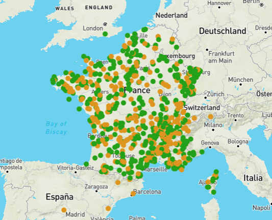
- JSON
- Data.gov Catalog
Hayward M7.0 Earthquake Scenario
data.sf.govUpdated 1 Oct 2026
… For Visualization: ≤ 5.5 = Light ≤ 6.5 = Moderate ≤ 7.5 = Strong ≤ 8.5 = Very Strong ≤ 9.5 = Violent
- JSON
- XML
- CSV
- VND.GOOGLE-EARTH.KML+XML
- VND.GOOGLE-EARTH.KMZ
- GEO+JSON
- data.gov.uk
Strule Network Contribution
OpenDataNIUpdated 7 Aug 2021
… for visualisation online in web maps. Analysis: This layer can be used in dashboards. Download: The data is …
- JSON
- GEOJSON
- KML
- CSV
- HTML
- data.gov.uk
Ballinderry Network Contribution
OpenDataNIUpdated 7 Aug 2021
… for visualisation online in web maps. Analysis: This layer can be used in dashboards. Download: The data is …
- JSON
- CSV
- GEOJSON
- HTML
- KML
- data.gov.uk
Strangford Network Contribution
OpenDataNIUpdated 7 Aug 2021
… for visualisation online in web maps. Analysis: This layer can be used in dashboards. Download: The data is …
- KML
- CSV
- JSON
- GEOJSON
- HTML
- data.gov.uk
Lagan Network Contribution
OpenDataNIUpdated 7 Aug 2021
… for visualisation online in web maps. Analysis: This layer can be used in dashboards. Download: The data is …
- CSV
- KML
- HTML
- GEOJSON
- JSON
- data.gov.uk
Faughan Network Contribution
OpenDataNIUpdated 7 Aug 2021
… for visualisation online in web maps. Analysis: This layer can be used in dashboards. Download: The data is …
- GEOJSON
- KML
- HTML
- JSON
- CSV
- data.gov.uk
Moyola Network Contribution
OpenDataNIUpdated 7 Aug 2021
… for visualisation online in web maps. Analysis: This layer can be used in dashboards. Download: The data is …
- KML
- JSON
- GEOJSON
- CSV
- HTML
- data.gov.uk
Owenkillew Network Contribution
OpenDataNIUpdated 7 Aug 2021
… for visualisation online in web maps. Analysis: This layer can be used in dashboards. Download: The data is …
- GEOJSON
- CSV
- JSON
- KML
- HTML